
Locate & Mark and Survey Mapping GPR
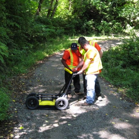
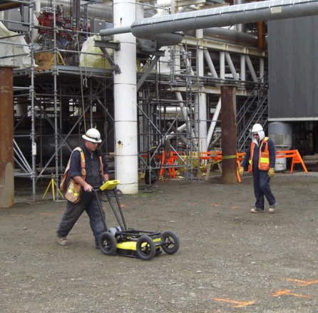
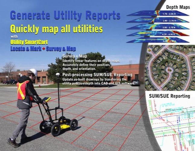
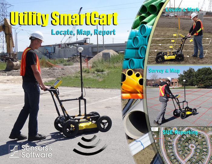
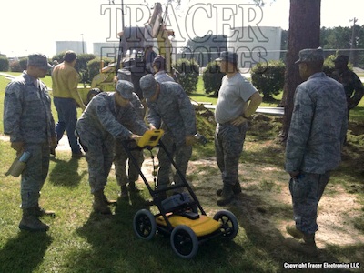
The Utility SmartCart is a complete GPR system built specifically for utility locating and utility mapping. The Utility SmartCart combines the easy-to-use locate & mark mode found in the popular LMX100 system with the Survey & Mapping data collection found in the Noggin SmartCart. The rugged cart design is also a feature of the SmartCart family and its collapsable for easy storage and transport. The Utility SmartCart is the perfect choice for users who spend much of their time locating but still need the abilities to collect data and produce multilayered utility mapping.
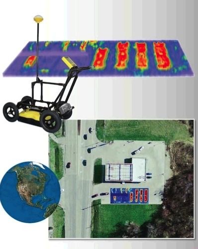
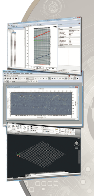
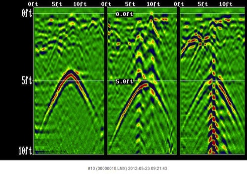
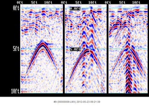
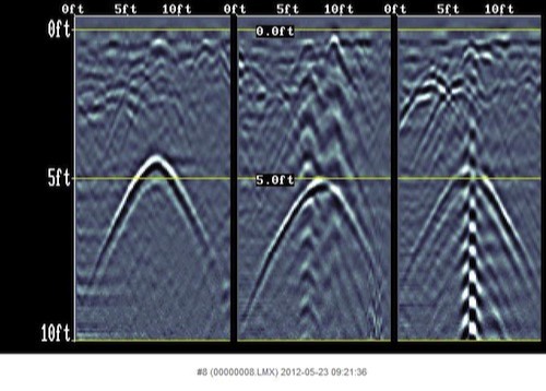
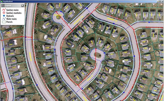
Full digital data recording is provided in Survey & Mapping mode. EKKO_Project software provides post processing. Viewing depth slices with EKKO_Mapper software from the grid data provides a unique view of complex installations.
Full digital data recording is provided in Survey & Mapping mode. EKKO_Project software provides post processing. Viewing depth slices with EKKO_Mapper software from the grid data provides a unique view of complex installations.
- Software
- Screen Shots
- Parts
- Accessories
- Storage Case
- GPR Suitability
- Repairs
- Training
- Specifications
- Resources
Tab 1
EKKO_Project Base software and its optional modules are an important component of any GPR system being used for detailed underground utility mapping.
- EKKO_Project
- Other Software
Tab 1

EKKO_Project is the all-inclusive software solution for managing, displaying, processing and interpreting GPR data. It provides easy, efficient analysis and integration of GPR and associated data.
EKKO_Project consist of a base program and three optional modules.
EKKO_Project consist of a base program and three optional modules.
EKKO_Project works with project files generated by the GPR hardware. An embedded database structure allows all GPR data and ancillary files to be housed in a single .gpz file for a specific project.
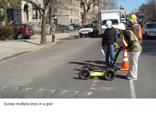
A project could be a single GPR line or hundreds of lines and grids from an easy or complex survey.
A project could be a single GPR line or hundreds of lines and grids from an easy or complex survey.
Tab 2

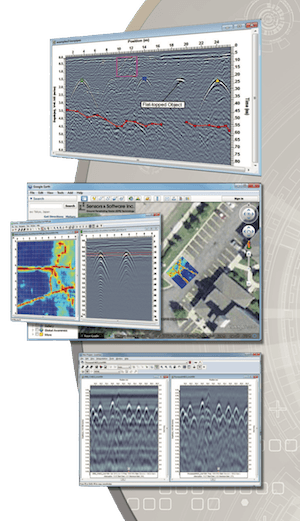
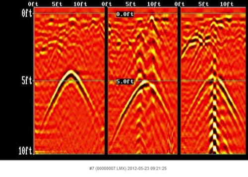
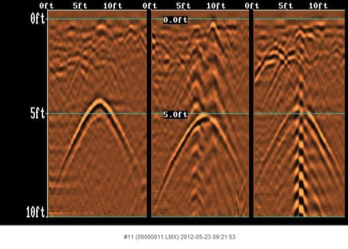
Interpretation Module enables users to add interpretations to GPR lines.

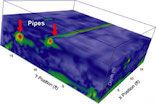
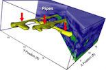
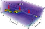
SliceView Module displays the GPR data collected in a grid as a series of depth slices cutting into the subsurface.
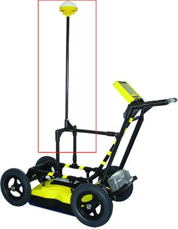
Optional GPS integration necessary for overview satellite asset mapping.
Optional GPS integration necessary for overview satellite asset mapping.

Processing Module provides a range of common GPR signal processing and analysis tools.

3 D Visualization provides the means to display volume, variable-opacity views, iso surfaces and oblique slices, rotation and different colormaps. These tools greatly aid in determining underground utility mazes without ever disturbing the soil, parking lot, etc.
Tab 2
Tab 3
- Antenna
- DVL
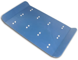
- Skid Plate
- Odometer
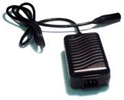
- Battery
- Charger
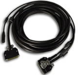
- Cables
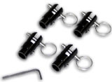
- Swivel Mounts
Tab 1
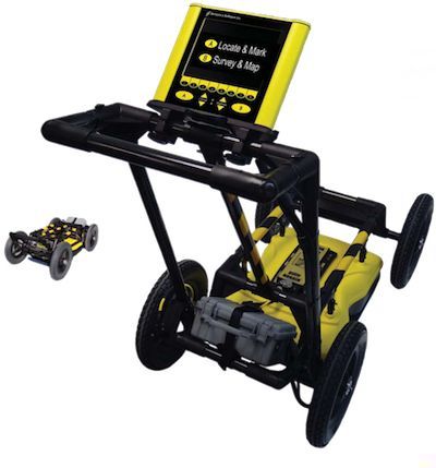
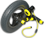
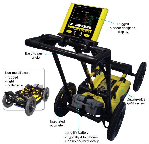
The 250 MHz antenna is the workhorse of the utility locating & mapping industry. 250MHz provides the best resolution and depth for cable & pipe locating and mapping. The same antenna is standard on the Utility SmartCart & LMX100 systems.
Tab 2
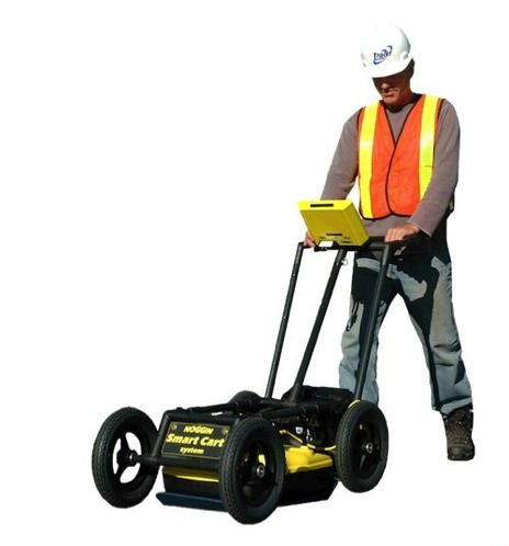
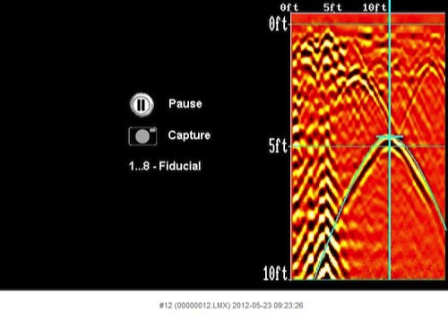
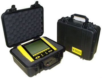
The Digital Video Logger (DVL) with embedded software provides user control, data saving and real-time display of the SmartCart GPR data.
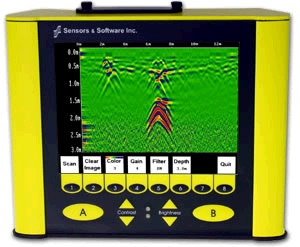
Key Features:
- High speed processing and display
- Supports data collection for survey & mapping
- Supports 250Mhz antenna
- Bright, high contrast, sunlight visible LCD screen
- Color Display
- Weather-proof
- Support of large flash storage memory
- Serial port for GPS integration
Tab 3
Tab 4
Tab 5
Tab 6
Tab 7
Tab 8
Tab 4
The Utility SmartCart with optional accessories makes for a very versatile GPR platform. The Utility SmartCart underground utility locator can quickly become a utility mapping system complete with GPS accuracy and 3D data processor. All wearable parts and accessories are easily accessible and affordable.
- GPS
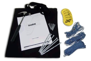
- Easy Grid
- DVL Carry Case
Tab 1
Tab 2
Tab 3
Tab 5
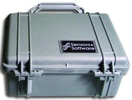
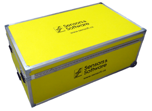
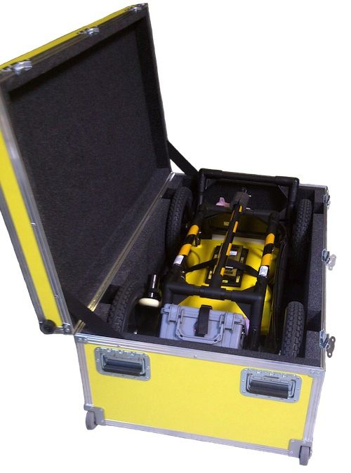
These ruggedized ATA approved cases are perfect for storing on board work truck or construction site or for air travel between job sites. Storage cases help eliminate the risk associated with operating electronic instruments in tough environments and using them reduce overall cost of ownership.
Tab 6
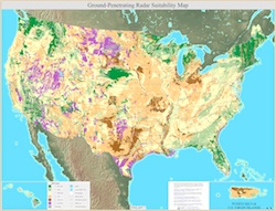
GPR Soil Suitability Maps are ideal for reviewing your area for conducive GPR locating. These maps are very detailed and are very large files. Please be patient and allow time to render in your browser.
Tab 7
Tracer Electronics LLC provides repair services for Sensors & Software LMX100 & Utility SmartCart GPR carts. Tracer Electronics LLC is a USA factory authorized warranty repair center.
Tab 8
Tracer Electronics LLC provides FREE on-site GPR cart demonstrations and FREE GPR training with purchase of new Sensors & Software LMX100 & Utility SmartCart GPR systems.
On-site training is currently available for AL, FL, GA, KY, NC, SC, TN.
Tab 9
Height:
Width:
Length:
Weight:
Power:
Battery Type:
Battery Capacity:
Environmental:
Temperature:
Signal Enhancement:
Spatial Interval:
Dynamic Depth Ranges:
Depth Estimates:
Image Storage:
Width:
Length:
Weight:
Power:
Battery Type:
Battery Capacity:
Environmental:
Temperature:
Signal Enhancement:
Spatial Interval:
Dynamic Depth Ranges:
Depth Estimates:
Image Storage:
43.3" (110 cm)
21.7" (55 cm)
35.4" (90 cm)
57 lbs (26 kg)
1.25 A @ 12V
Lead Acid Gel Cell
9 Ah
IP66
Sensor: -40 C to +50 C
DVL: -5 C to +50 C
Dyna Q/Fixed stacks
Adjustable
Collects data to 1.5 to 100 ft. (1.5 to 30.5m)
Displays to 0.5 to 100 ft. (0.2 to 30.5m)
Real-time analysis
up to 16 GB
21.7" (55 cm)
35.4" (90 cm)
57 lbs (26 kg)
1.25 A @ 12V
Lead Acid Gel Cell
9 Ah
IP66
Sensor: -40 C to +50 C
DVL: -5 C to +50 C
Dyna Q/Fixed stacks
Adjustable
Collects data to 1.5 to 100 ft. (1.5 to 30.5m)
Displays to 0.5 to 100 ft. (0.2 to 30.5m)
Real-time analysis
up to 16 GB
Tab 10


Locate & Mark
Survey & Mapping (GPR)
(full featured ground penetrating radar system)
Survey & Mapping (GPR)
(full featured ground penetrating radar system)

Utility SmartCart