

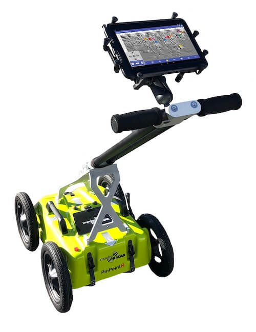

- Compact Design
- Dual Channel Antenna
- Wireless Data Acquisition
- How does GPR work?
- Real-time Sampling (RTS)
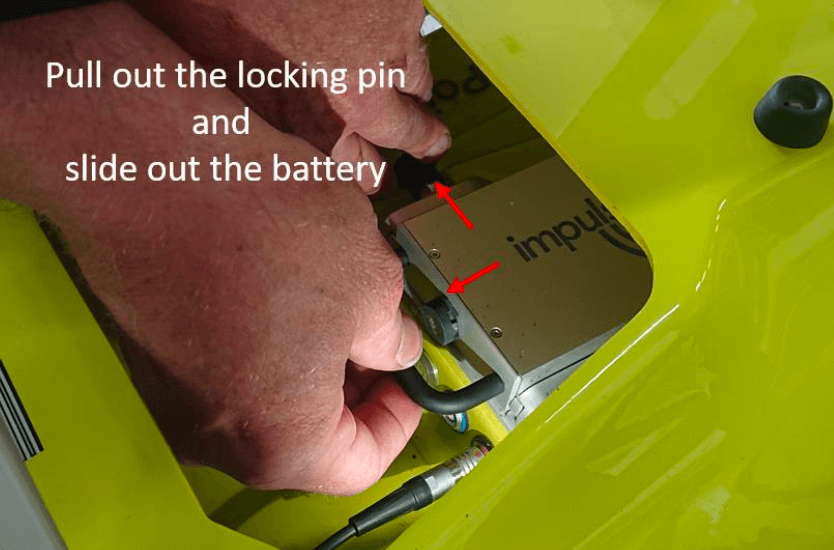
- Li-Ion Battery
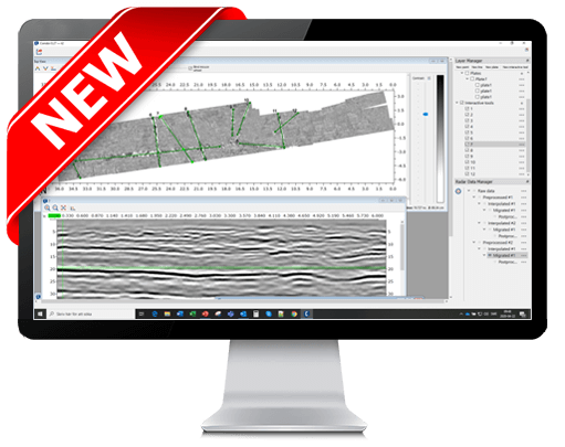
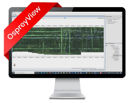
- ViewPoint
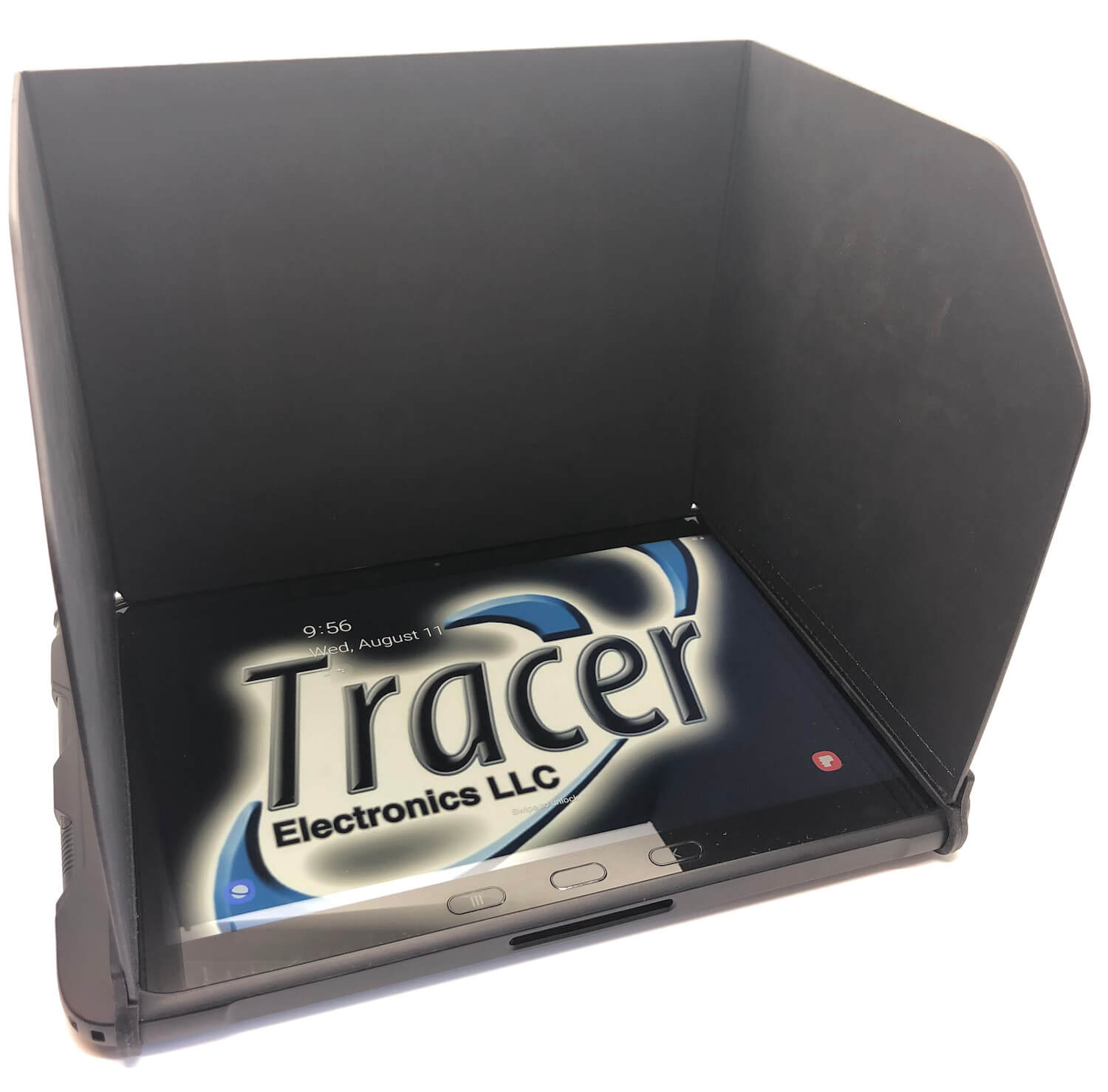
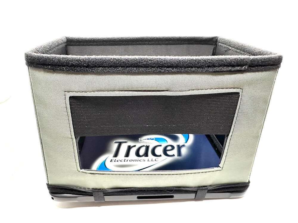
- Tablet
- Tablet Case
- Screen samples
- Warranty
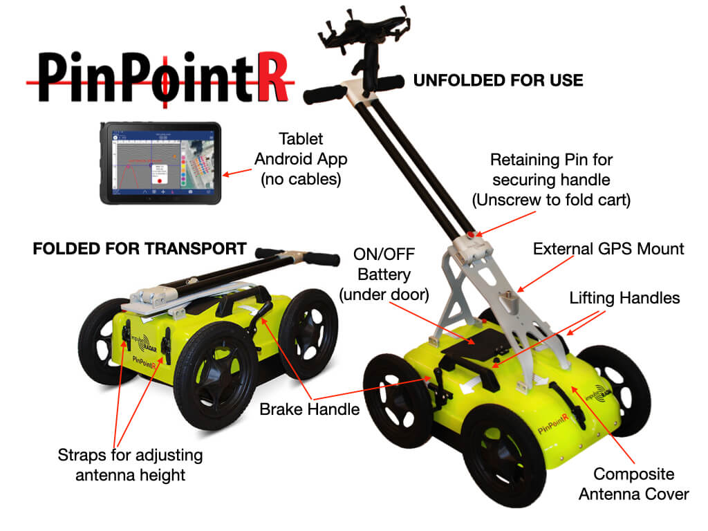
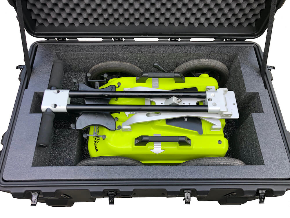
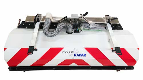
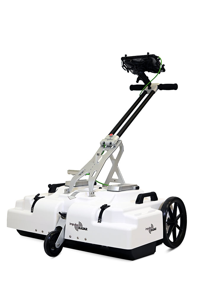
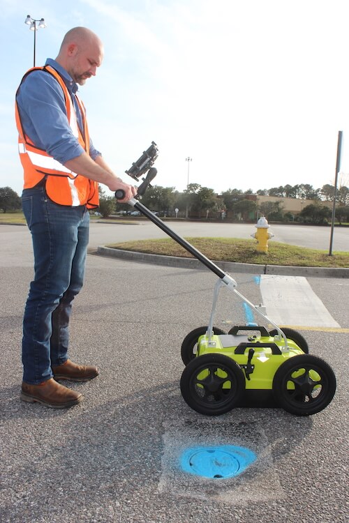
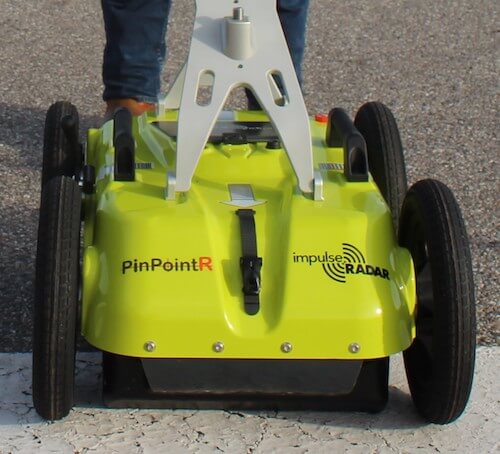
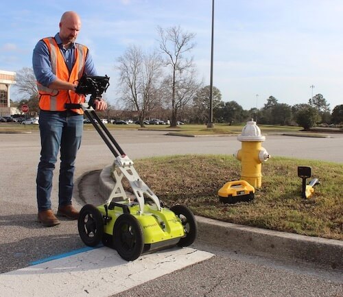
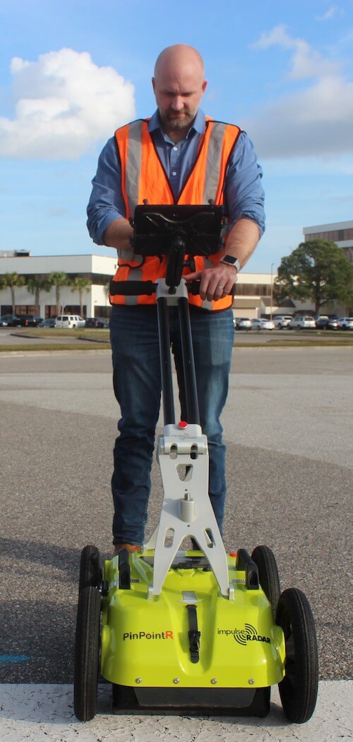
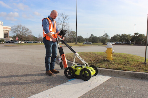
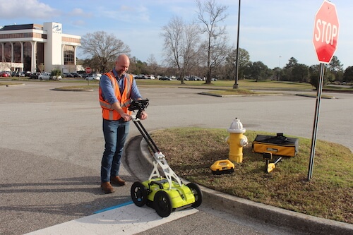
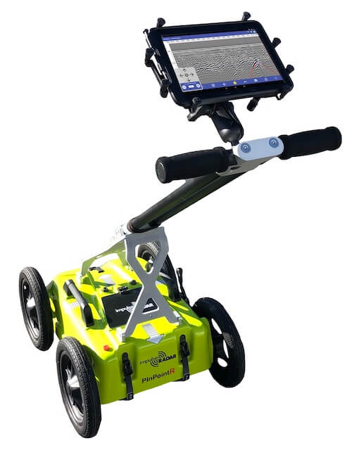
Light-Weight Compact & Robust Design
The PinPointR's lightweight design (only 44 lbs.) and its foldable frame are perfect for utility locators who do multiple locates a day and need to continuously transport, store, and set up at different Job sites. This design makes transporting much easier and can be stored in smaller vehicles, giving owners more options. In addition to premium materials, its composite antenna weather-cover enclosure is used. This composite enclosure provides another level of protection, making the PinPointR the industry leader for robust design.
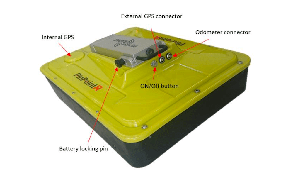
Internal GPS, with external GPS support (NMEA 0183 protocol).
Key Features:
- Composite Antenna Housing - WEATHER PROTECTION
- Integrated Odometer - BUILT-IN
- Large Wheels - STANDARD
- Folding Handle - EASY TO STORE
- Lifting Handles - EASY TO LIFT
- Brake - SECURE CART ON INCLINE
- Skid Plate - REPLACEABLE
- Ratchet Straps - QUICKLY ADJUSTS ANTENNA

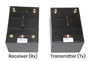
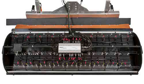
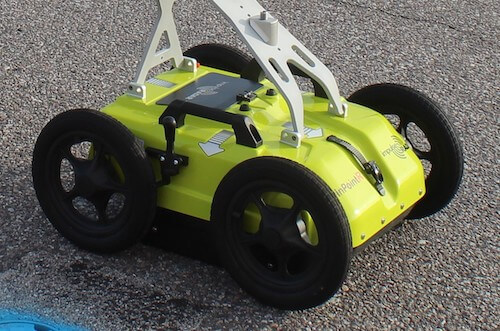
True Dual Channel Radar Antenna Technology
Dual-channel radar from Impulse Radar operates at 400 MHz (LF) & 800 MHz (HF), providing enhanced bandwidth and resolution far beyond any single-channel GPR's capabilities. Along with its RTS-based wireless antenna technology, high performance, and no survey speed limitations, this gives users the best opportunity to locate deeper and near-surface targets, even in tough soil conditions, without worrying about how fast to push the cart.
Article: Single-channel UWB vs Multi channel GPR
Key Features:
- 400MHz & 800MHz- DUAL FREQUENCIES
- Li-Ion Battery - INTEGRATED DESIGN
- GPS - INTERNAL GPS RECEIVER
- GNSS/RTK - CONNECTOR FOR EXTERNAL
- RTS Platform - REAL-TIME SAMPLING
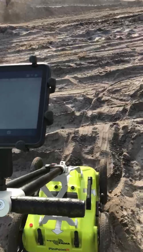
Wireless Data Acquisition Technology
No cables to be lost or broken, which simplifies set-up and in-field productivity and reduces service cost. Utilizing wireless design improves its overall cost of ownership.
However, for the owner, the best news of all may be having the latest Samsung tablet as your "digital video recorder" or head unit. Using a proven Samsung device via an Android app, such as ViewPoint, provides users with a proven, affordable, and user-friendly design.
Impulse Radar continues to improve and add features, and all these features are available to you via its normal Android App updates.
Using the latest Samsung tablet guarantees the latest display and processing technology, and if something ever goes wrong, is lost, or is stolen, it is very affordable to replace. Whereas competitive systems that depend on in-house-built display units are only as new as the year they were designed, extremely difficult to keep up to date, and very expensive to replace.
The PinPointR wireless design solution is a clear win-win for any cart owner.
Key Features:
- Wireless - NO CABLES TO FAIL
- Tablet Display - UTILIZE LATEST LCD
- Android - OS RUNS ON TABLET
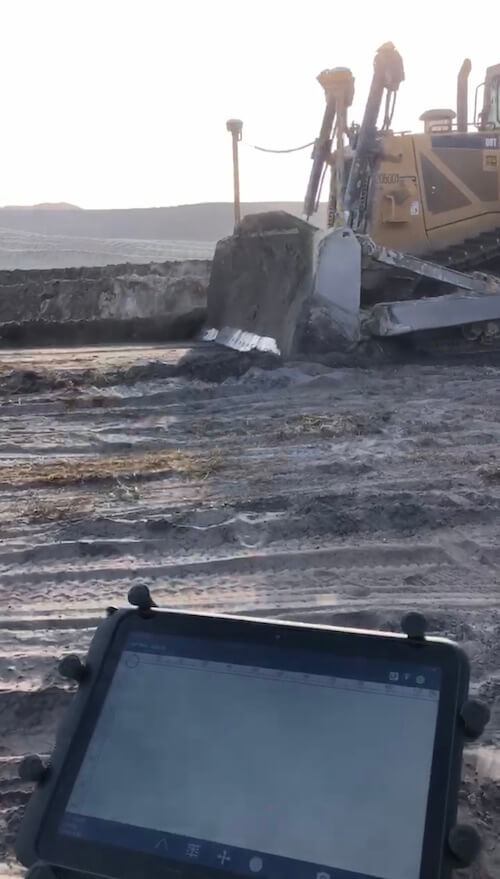
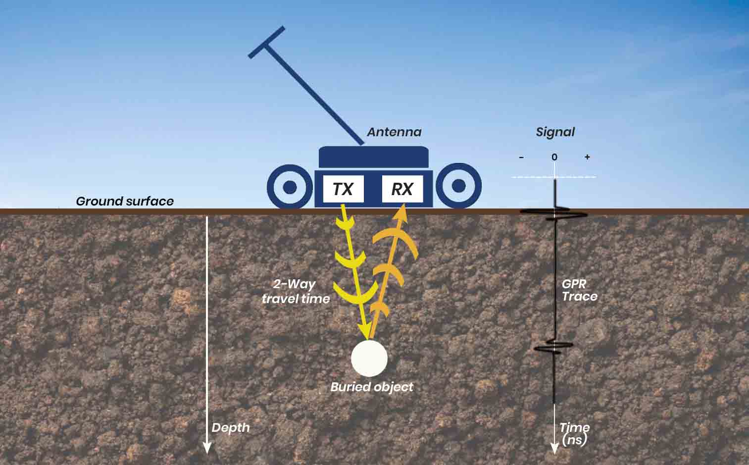
How does GPR work?
GPR works by transmitting a small pulse of ultra-wideband (UWB) electromagnetic energy into the ground, where targets are searched for, and then recording the time it takes for some of that energy to return to the receiver, along with a measure of its signal strength. A GPR antenna, which contains both transmitting and receiving elements, is placed on or very near the surface of the earth and moved across the area to scan. By continuously transmitting pulses and recording the associated returns, a radiogram image of the subsurface can be generated and viewed in real time on a suitable screen (e.g., a tablet). Changes in the Earth's subsurface composition can be seen based on air, mineral, and water content, the presence of bedrock or other geological features, and objects such as buried utility lines.
Key Features:
- No need to hook-up - BUILT-IN TRANSCEIVER
- Locates non-metallic - LOCATE PLASTIC, CONCRETE PIPE
- Confirm Locates - GPR CAN CONFIRM EM
- Sweep for utilities - GPR IS A PERFECT METHOD FOR SWEEPING
- UnLocatables - GPR CAN LOCATE DIFFICULT UTILITIES
- Plastic Pipe w/No tracer wire - GPR CAN LOCATE THE PLASTIC PIPE
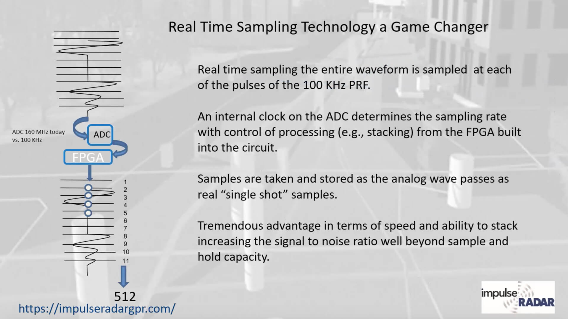
Signal sampling methods
All GPR systems need to sample analog signals from the antenna and digitize them for processing and display. The sampling method and the rate at which samples are taken can significantly affect the quality of results. Therefore, the sampling rate is an important specification that determines system performance.
Traditionally, GPR systems have used a technique called equivalent-time sampling, which requires a new pulse to be sent from the transmitting antenna for every sample recorded at the receiver. We refer to systems using this method as "conventional GPR".
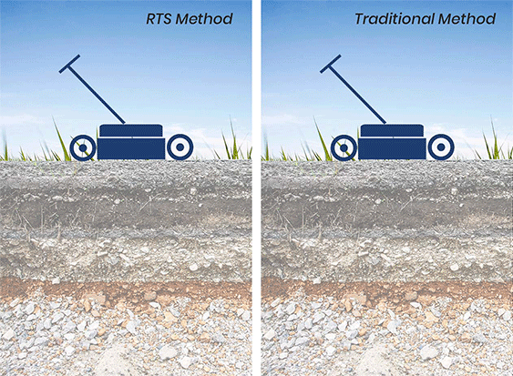
RTS - Real-time sampling
Modern designs and new components now make it possible to use a technique called real-time sampling (RTS). RTS is the method that Impulse Radar uses in all its designs. As their name implies, the "real" signal is captured directly, and, in sharp contrast to conventional systems, it does not require repeating the transmission-recording cycle. The rest is a GPR system that gathers data thousands (1,000x) of times faster than a conventional GPR system.
Key Features:
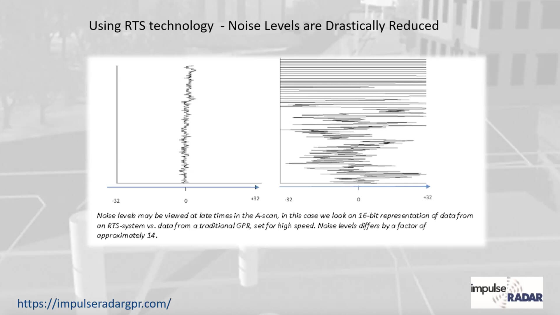
- Real-Time Sampling (RTS) dramatically reduces background noise levels, making it possible to see underground targets that other systems cannot see.
- This is accomplished by collecting tens of thousands more data stacks in the same or less time frame.
- There are no longer speed limitations on how fast you push or pull the antenna across the ground. Older systems have limitations and require much slower data collection. Some older systems even display a color oriented indicator to let users know they need to slow down.
- Having no speed limitations make the PinPointR a much safer system to operate in busy intersections.
RTS Technology provides thousands of data stacks, which dramatically reduce background noise levels, providing greater depth of penetration. This can be achieved without sacrificing data-collection speed, unlike some other competitive systems. E.g., the Raptor array setup can achieve these results at speeds of up to 80 MPH. Therefore, the PinPointR push cart has no limitations, so there is no need to monitor how fast one should collect data. Other systems that utilize similar stacking techniques require very slow walking speeds and may even need to monitor the speed at which you push the cart to slow the user down if necessary.
Simplicity
An RTS system does not require the control unit that is central to the configuration of conventional GPR systems. Consequently, there are fewer cables and inter-module communications, making the RTS system more practical and field-friendly. Not having a dedicated control/display unit is much less likely to go wrong and much less costly to replace.
Penetration depth/sensitivity
Since an RTS system collects data much faster, the collection rate is used to lower the system noise floor, thereby increasing the signal penetration depth. To our knowledge, true 16-bit data has never been acquired with conventional GPR systems, whereas an RTS-based system may easily exceed 20 bits.
Survey speed
While conventional systems can rarely be used at speeds above 50 km/h (without increasing the point distance), an RTS system can be used at virtually any speed. This equates to quicker surveys and, more importantly, faster searching for utilities at busy intersections, as users can quickly scan an area as needed to avoid oncoming traffic, making the PinPointR a much safer GPR cart for utility locating technicians.
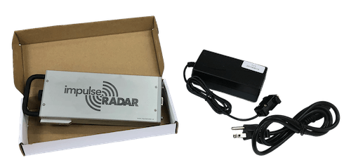
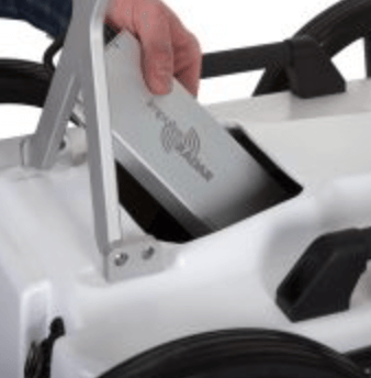
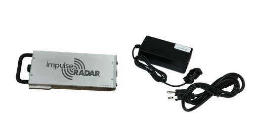
Li-Ion Battery
The PinPointR is standard with a high-capacity rechargeable Li-Ion battery pack. This battery is designed to last up to 7-hours continuous operation.
Key Features:
- Li-Ion Battery - RECHARGEABLE
- Integrated design - NO CABLE OR BOX
- Extreme Life - 7-HOURS
- Long Service Life - LASTS 1,000 CYCLES

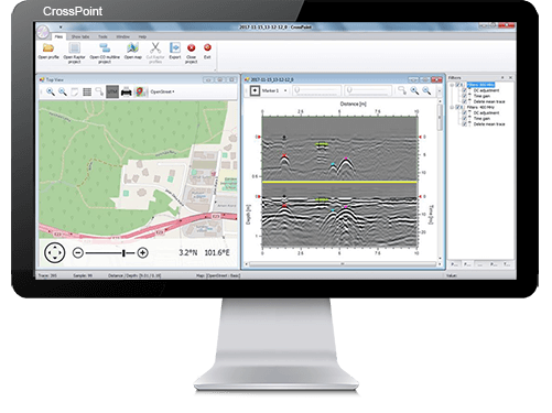
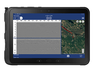
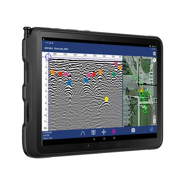
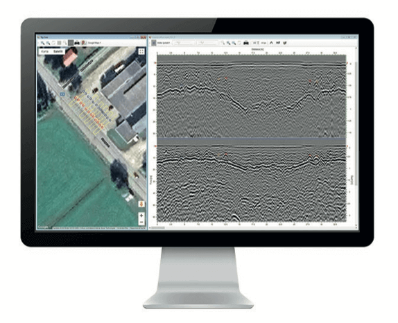
ViewPoint
ViewPoint from Impulse Radar is an Android data acquisition application (App) that controls the PinPointR antenna and features. The ViewPoint App enables wireless connectivity between the tablet and the antenna and features an intuitive user interface to maximize your in-the-field productivity, with functionality designed around your daily workflow.

Key Features:
- View Maps simultaneously in real-time
- Single or multi-line collection
- Mapping with Google Earth support - generate KMZ files
- Geo-referencing with Google Map integration
- Use built-in GPS antenna or external GNSS RTK
- Add APWA uniform code markers while you locate
- Multi or Single channel selection (400 MHz & 800 MHz)
- Depth & Soil velocity setting via hyperbole matching
- Apply gain at various depths or the entire line
- Pinch to Zoom, in and out - Intuitive
- Save Raw line data to tablet
- Automatic Field Report generation
- Email on-site reports (PDF) from tablet
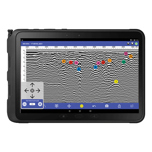
Ruggedized Tablet Display
PinPointR uses an Android-based acquisition application that provides data acquisition and control via tablet or smartphone. WiFi - wireless data collection and data logging. When paired with the Samsung Tab Active Pro Ruggedized tablet, users get an excellent high-definition display along with the latest Android OS (Pie). Meets MIL Spec. STD-81DG and is IP68 rated.
Key Features:
- Galaxy Tab Active Pro 10.1 - SAMSUNG
- 1920 X 1200 Pixel or better - SCREEN RESOLUTION
- Android 15 or newer - ANDROID OS
- 6 GB RAM/128 GB or better - MEMORY
- Qualcomm Snapdragon, Octa-core 1.8 GHz or better - PROCESSOR
- Meets MIL Spec. STD-81DG - RUGGEDIZED
- IP68 - WEATHER AND DUST RESISTANT
Other GPR carts using in-house builds for display units typically become obsolete before they even go one or two years into production. They are often sourced with older LCD screens and obsolete OS throughout their life cycle. These OEM display units also cost at least 5x as much to replace should one ever be damaged or lost.

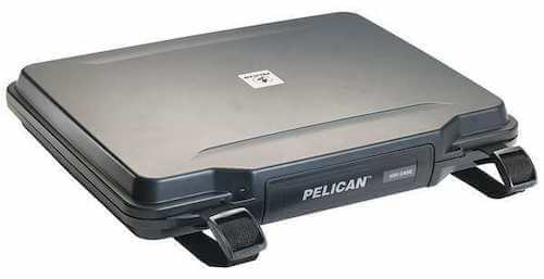
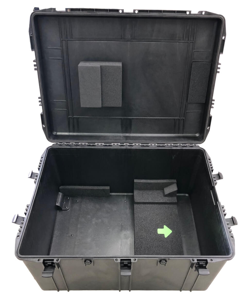
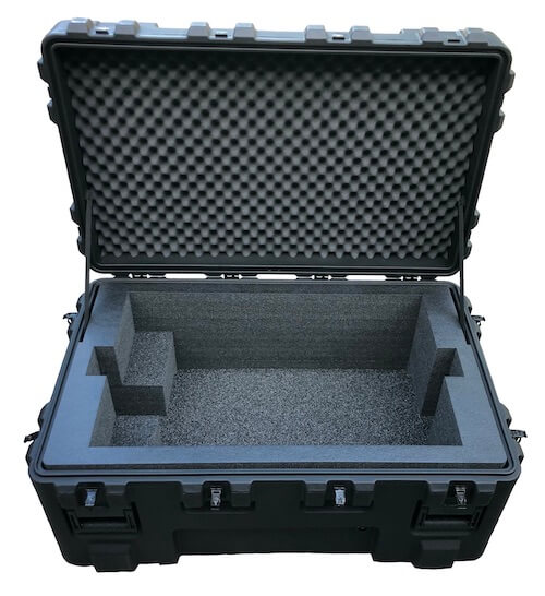
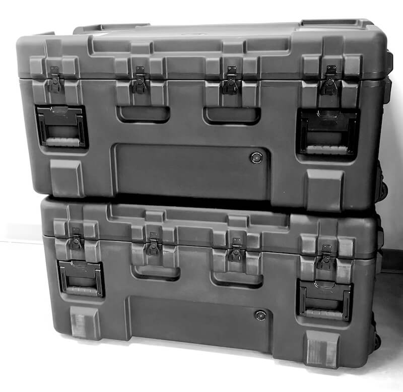
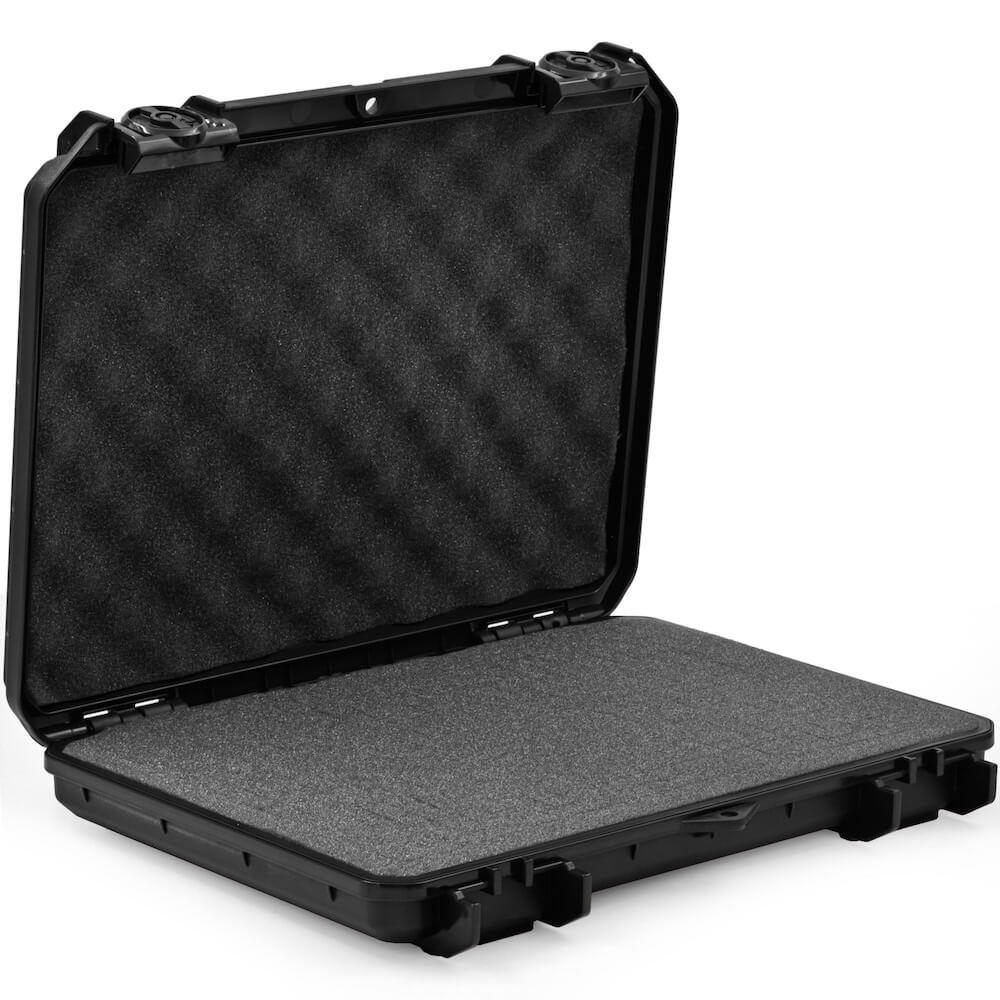
Ruggedized Case
Protect your Tablet with a Seahorse ruggedized case.
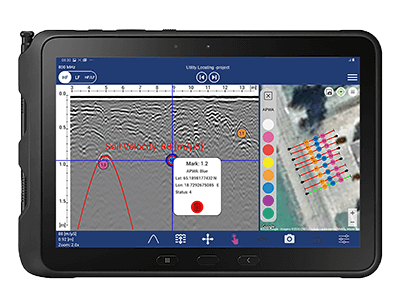
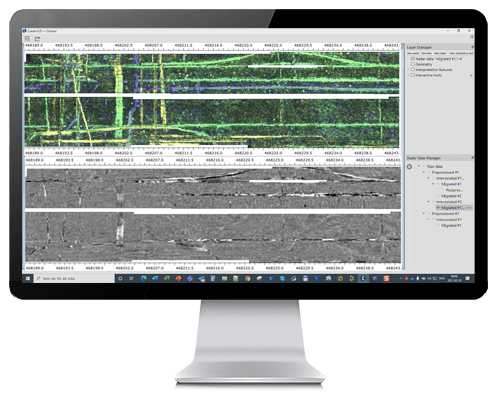
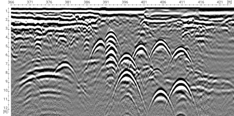
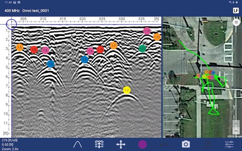
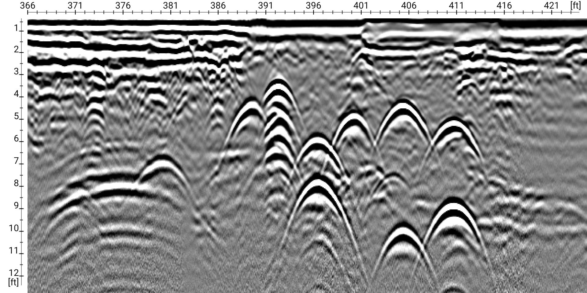
Using 400MHz
The Real-time sampling provides superior data, even in tough scenarios. Shown are targets at different depths. Notice the antenna using RTS technology has excellent resolution on both shallow and deep targets.
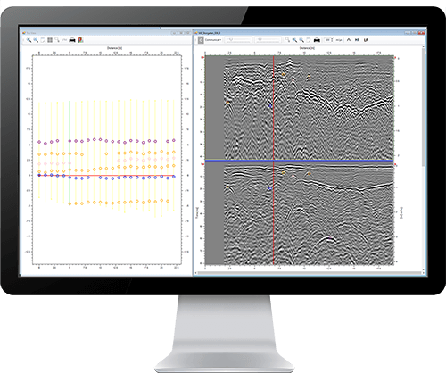
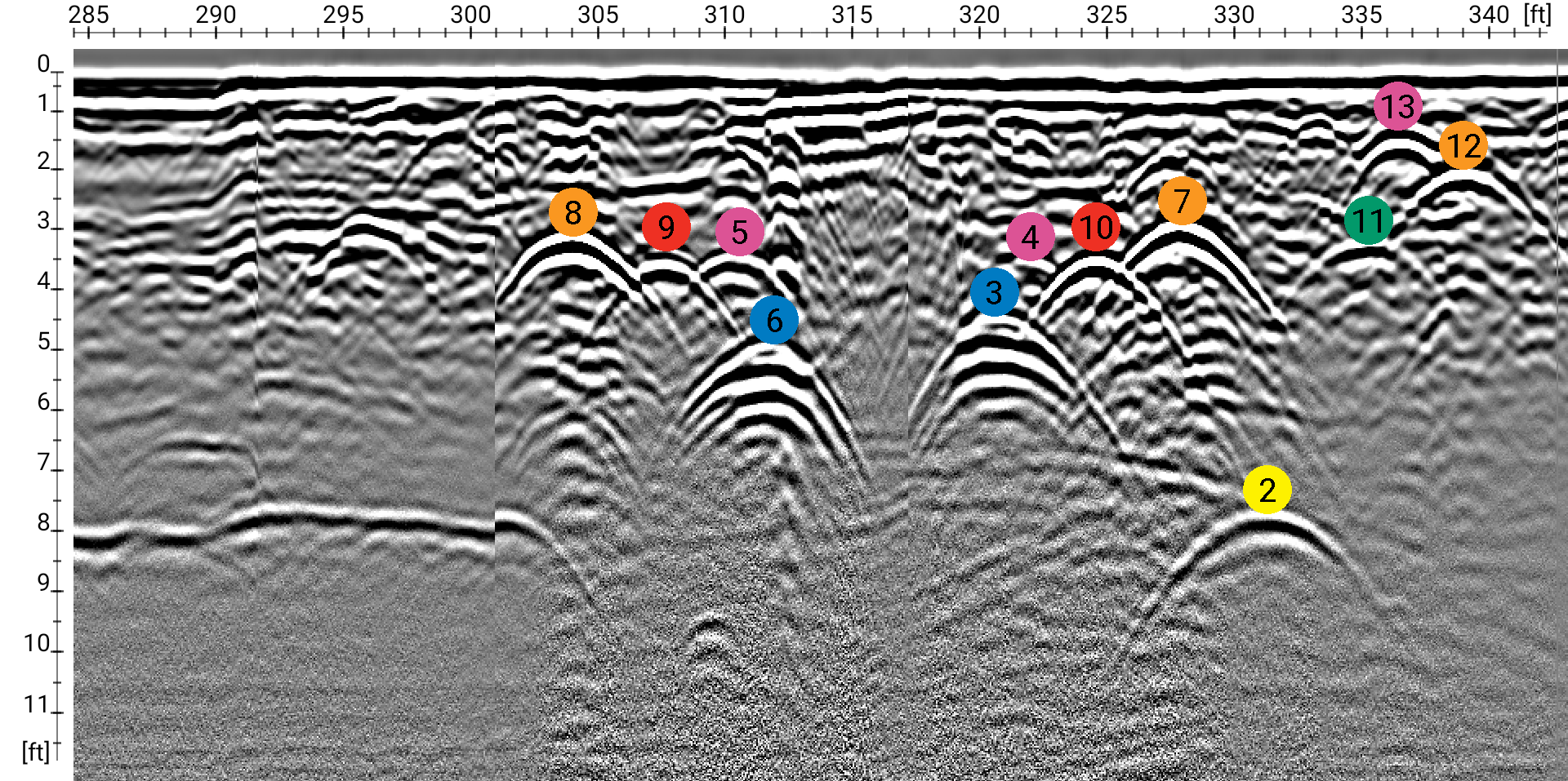
Markers
The Marker button allows users to mark pipe targets with the corresponding APWA Color marker.
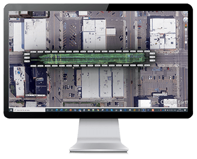
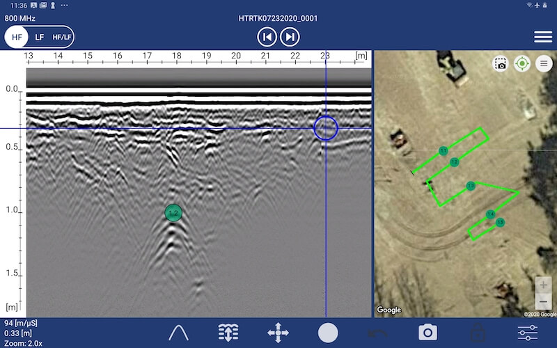
Mapping
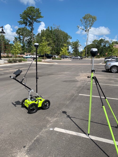
The Mapping feature of the ViewPoint app provides automatic mapping when the cart is used. Below, using the internal GPS.

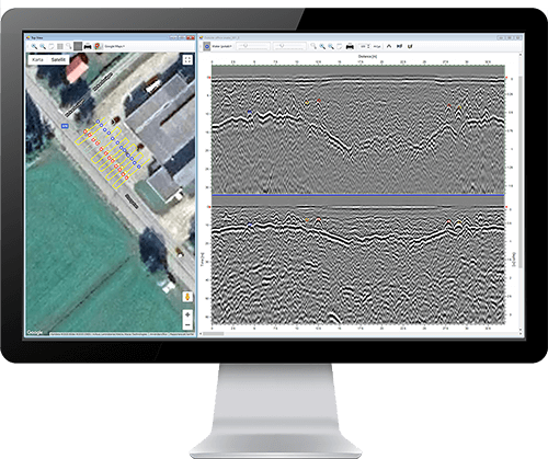
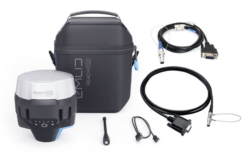
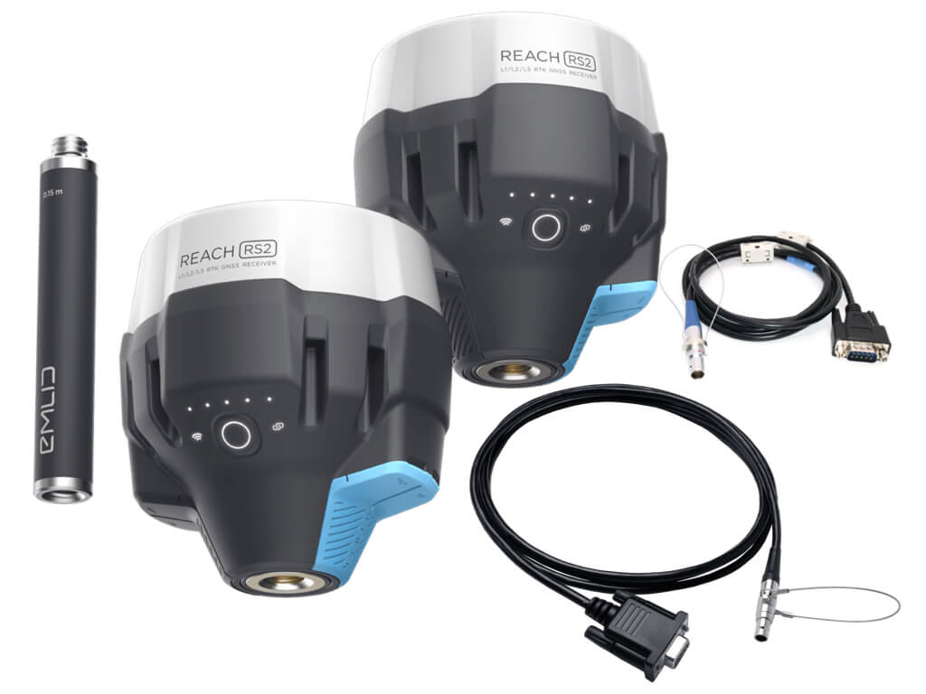
Mapping w/RTK GNSS
The Mapping feature of the ViewPoint app uses the optional EMLID RTK GNSS receiver (>1cm).
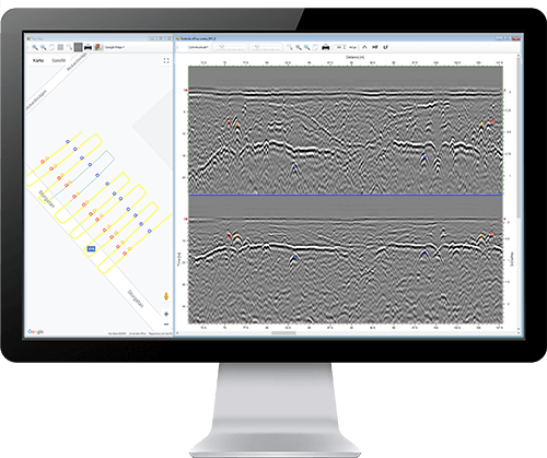
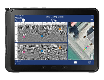
Using 800MHz with RTS
The high frequency (800 MHz) is ideal for detecting shallow targets. A power cable is shown ~2 ft. below the concrete slab.
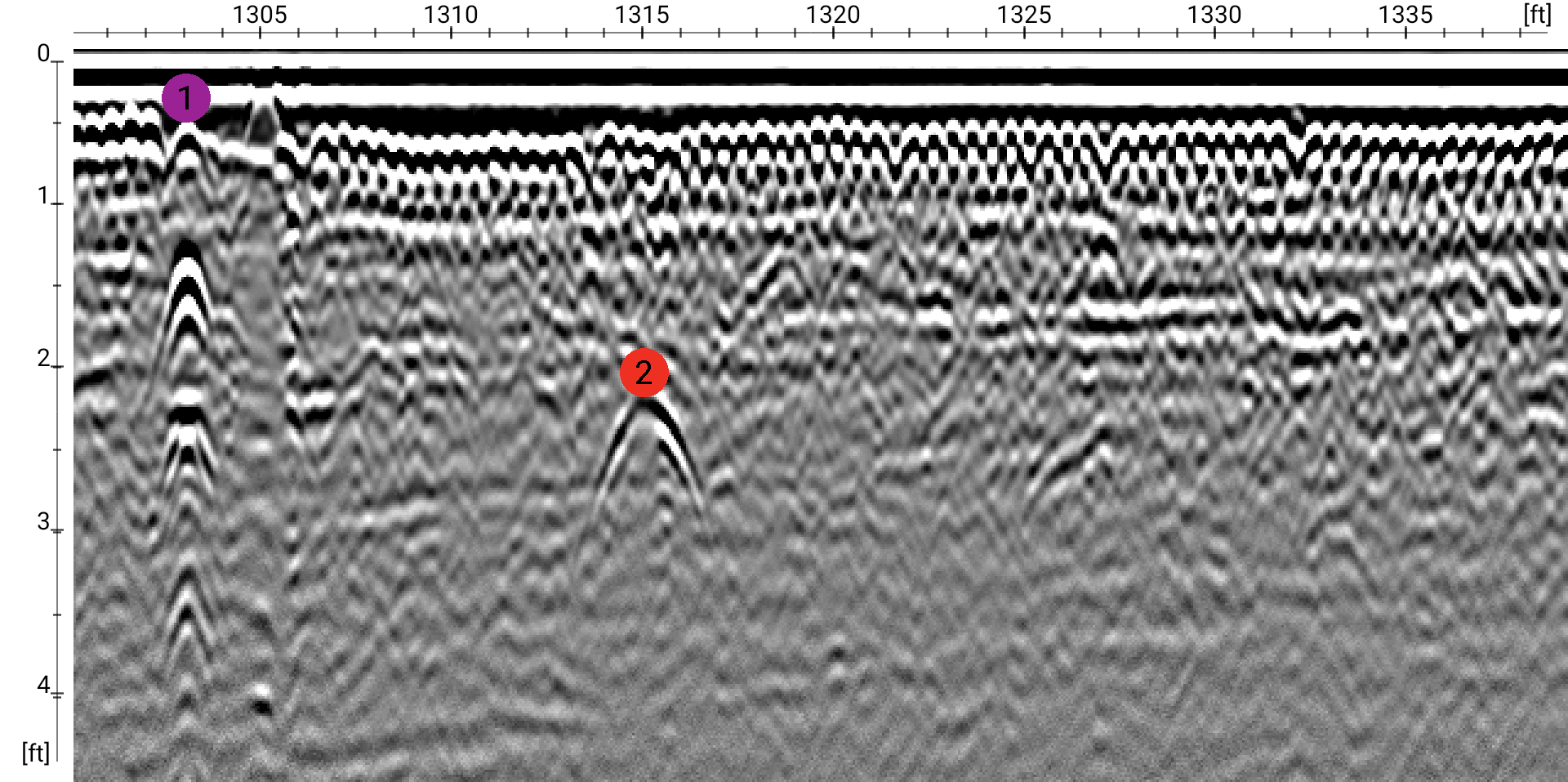
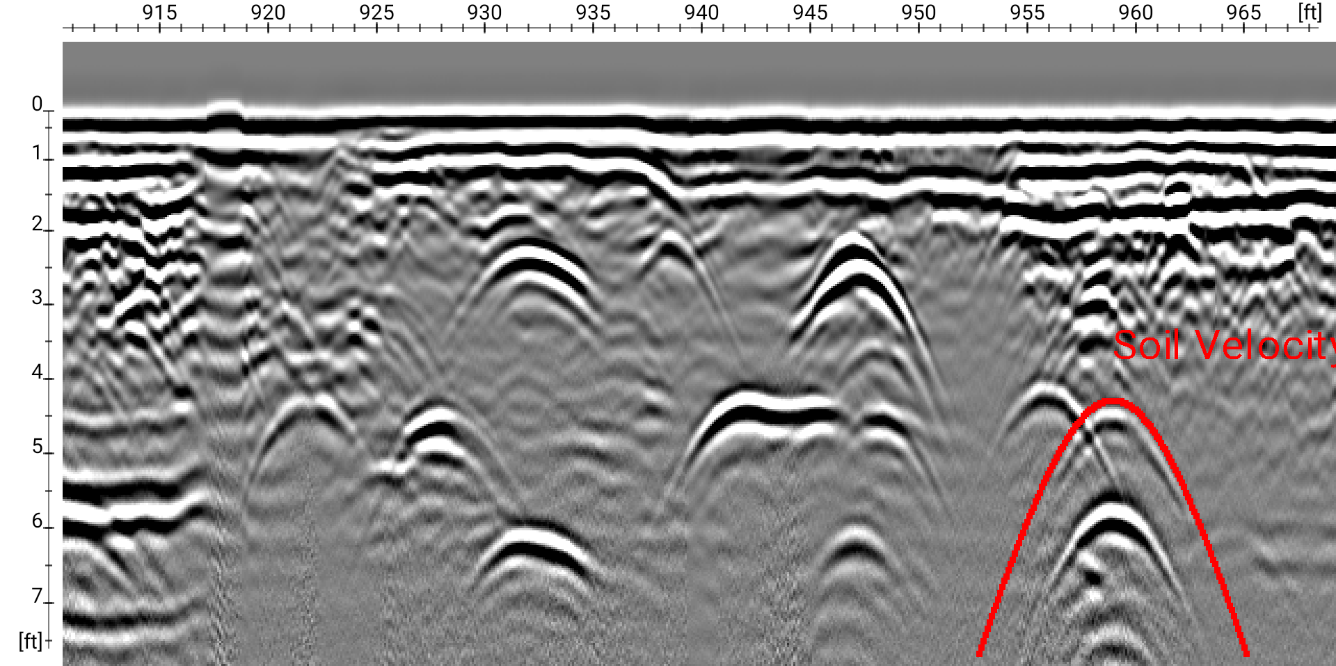
Soil Velocity Adjusting
Adjusting for different soil types is easy, fast, and accurate. Adjusting the velocity using the hyperbola matching ensures accurate depths.
Warranty
New warranty for 2026 models and newer.
5-Year Warranty - Antenna
2-Year Warranty - Cart Assembly & Battery
1-Year Warranty - Consumables (Skid Plate, Charger, etc.)