


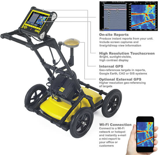
- Features
- Dyna-T
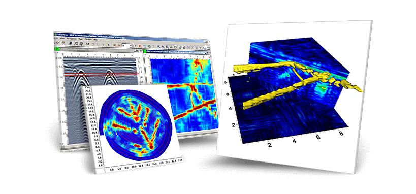
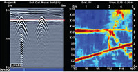
- Slice View
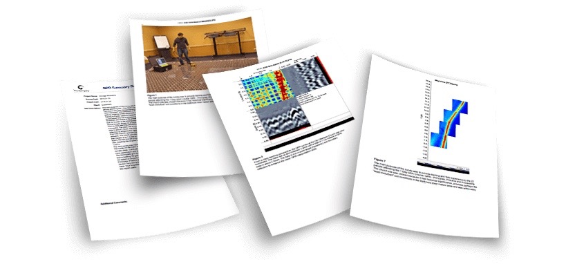
- Mini Reports
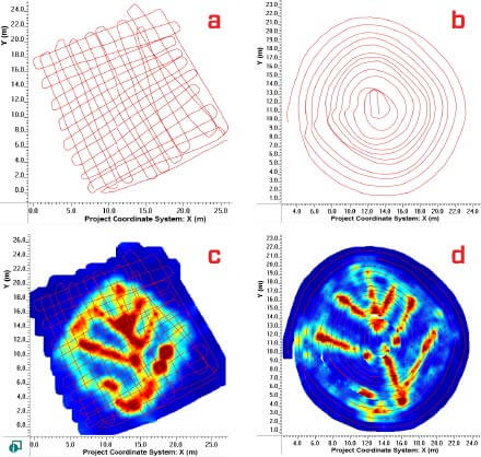
- Depth Slices
- Wi-Fi
- USB Data
- Interpretations
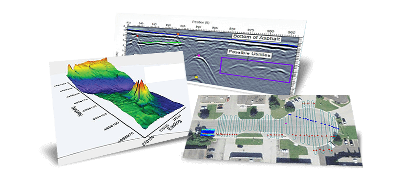
- Plan Map
- Google Earth
- Screen Capture
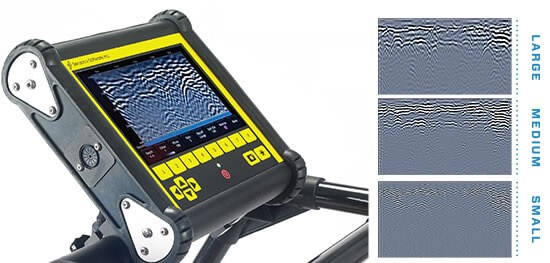
DYNA-T - Dynamic Target Enhancement
Advanced signal processing applied to data to change the effective center frequency. The expanded bandwidth signal produces enhanced higher frequency image, medium frequency image and lower frequency image. This allows for users to search for small shallow targets, medium targets and large deep targets. Users can also view data in “All” blended mode.
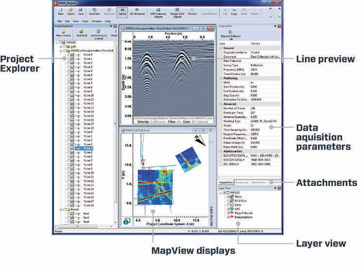
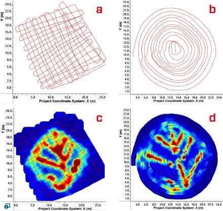
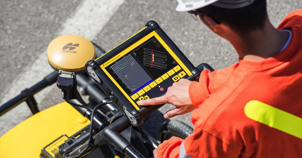
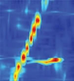
On-Site Slice View (GRIDS)
Produces on-screen grid data quickly and effectively, reveling underground utilities.
Mini Reports
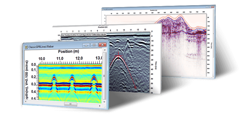
Produce instant reports that include a single screen capture and basic image information.
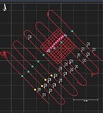
Depth Slice View
At complex sites, depth slicing reveals the orientation of pipes and cables at different depths and outlines the extent of vaults, foundations and buried tanks.
Wi-Fi - Built-in
Mini Reports are emailed from your LMX200 Cart through predefined Gmail account. This feature requires internet via Wi-Fi or hotspot internet data access.

USB Data Transfer
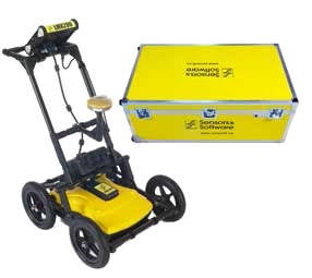
Data can be easily saved to a memory stick for archiving and transfer to a PC for further EKKO_Project use.

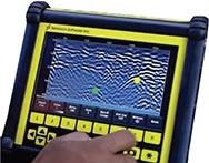
Field Interpretations
Classify targets in real-time with Field Interpretations. Use the touchscreen to color-code each target where it is located.
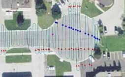
Plan Map View
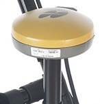
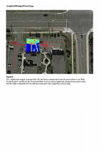
Using the external TopCon GPS kit, project file data including LineScan GNSS positions, rectilinear grids, flags, and field interpretations can be exported as Google Earth files (KMZ).
Enhanced Google Earth KMZ files
Display your location and targets in Google Earth and other similar geo-referenced platforms. Easily integrate utility locations into CAD drawings and GIS databases.
Screen Captures
At any point during the survey, you can save screen captures of line data, map views and depth slices. Perfect for producing quick mini reports.